Hi and Welcome!
For this last entry, we will stay in Canada but we’ll go travel the country onto the Pacific coast to have a look at Vancouver.
Pierre-Joseph Cancellieri | 114 112 124

Image 1: A view of Vancouver’s Downtown from a public park near the Gastown district
Vancouver is a relatively young city. The colonization of this part of the country is due to the gold rush around 1850. At this time, there were some settlements around the bay of Vancouver. The city has been found only on 1886 but its rapid urban growth transformed the city in a century to become the third largest city in Canada.
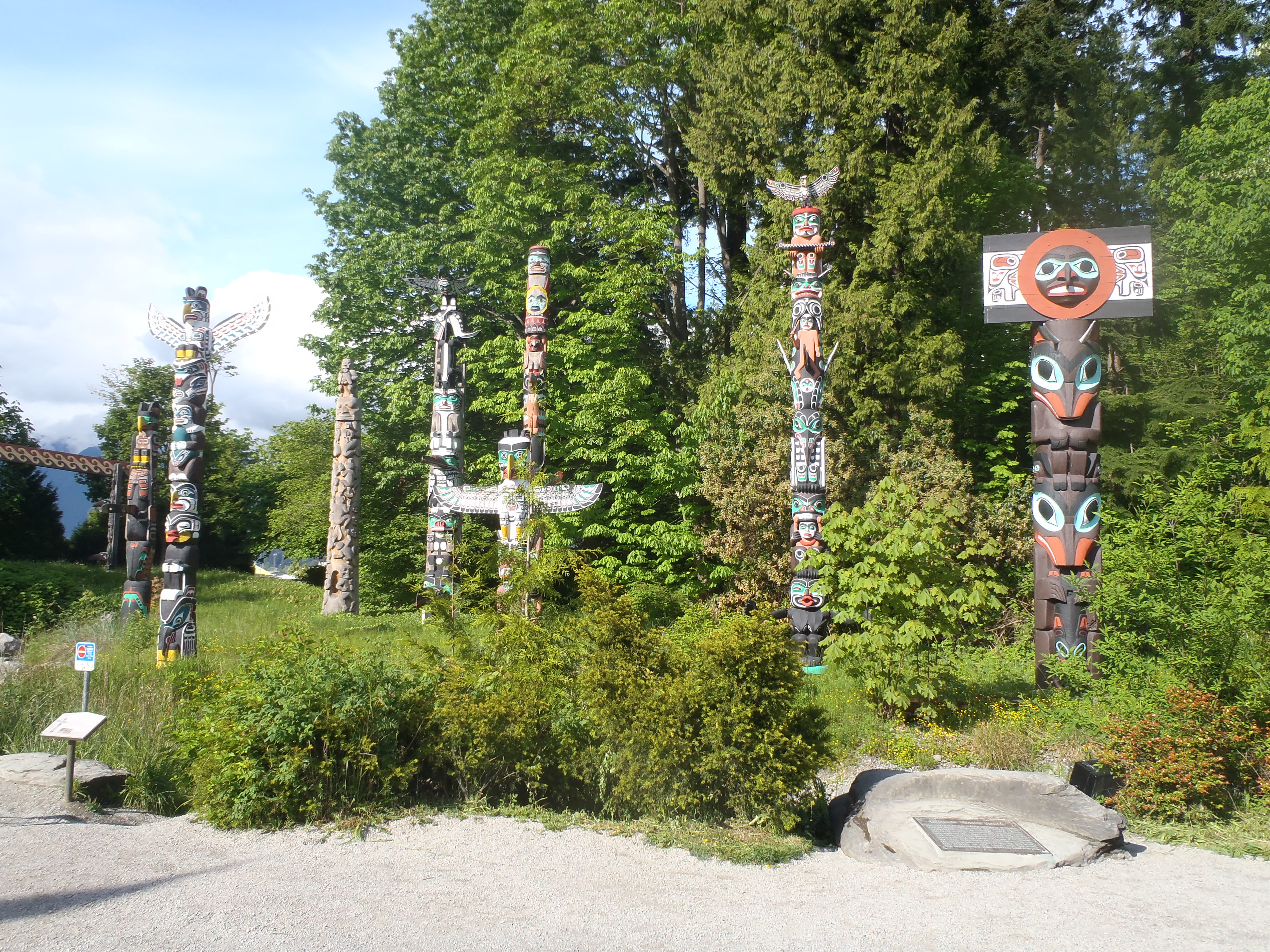
First, right after its foundation, Vancouver went through a boom period with the achievement of the Canadian line linking the country coast to coast. Also 3 weeks after, still on 1887, ships started to travel between Vancouver and China on regular basis. This is why Vancouver is such a cosmopolite city, both people from Asia and Europe went to it to start a new life. And there also is a general trend these past decades to emphasize the American Indian culture through public art.

Image 2: Indians totems in Stanley Park which reflect the willingness to revive the American Indian culture.

Image 3: Japanese piece of Art in Stanley Park. It reflects the diversity of the city which is influenced by Asian and European culture.
So as you can imagine the city has been really influenced by the construction of the railways line and the Canadian Pacific railways company. It’s true that city has been shaped by it but it’s not explaining everything. The city also experienced town planning quiet early and instaured a town planning by-law in 1926. The city Council called a firm to make a development plan. This plan was 50 years long but it was never applied. The Vancouverites had an early awareness of planning in order to keep controlled the development (meanwhile the city was booming) and to keep their city beautiful.
In a more recent history, Vancouver radically changed its downtown shape. From the 1940’s to the 1960’s, the buildings in the city centre became higher. Finally, we understand better why Vancouver became the Canadian sister or twin of San Francisco in the U.S. The bay, the bridge, the location of the downtown, and the uneven relief remind San Francisco.

Image 4: A view of Vancouver’ s Downtown area from the North side of the bay, suggesting the increase in the building’s heights

Image 5: View of the night skyline in Vancouver
Source: click here