
Hej Och Wälkommen !

Image 1.1: Panomaric view of Gamla Stan (old town of Stockholm)
Stockholm is the capital of Sweden and the largest city in Scandinavia. It was founded around 1250 on an island between 2 lakes; Malar Lake and Saltjsö Lake to protect other cities in the inner lands from piracy attacks. The presence of water is very important and the geography of the city is composed of islands, lakes and hills.
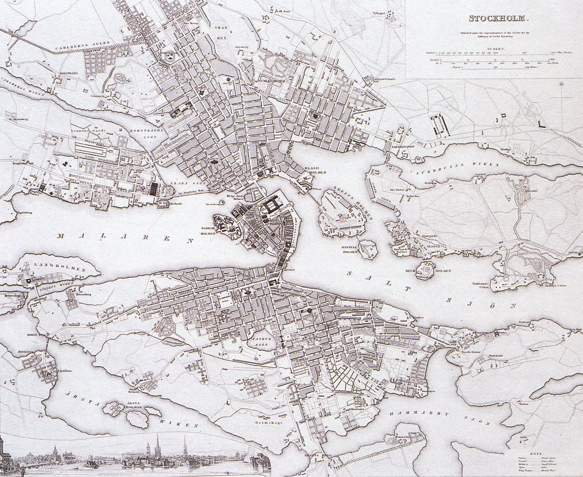
Map 1.1: Map of Stockholm in 1836. Gamla stan is the central island, North of it there is Nörrmalm and South of it, Södermalm
Stockholm today can be compared to other cities built on water such as Amsterdam, Holland or Bruges, Belgium. Dissimilarly, its shape is closer to Paris. Gamla stan (central island of Stockholm, see Map 1.2) can be compared to l’île de la cité in Paris and Nörrmalm and Södermalm to the both sides of the Seine river (see Map 1.1).
Stockholm is interesting due to its old tradition of planning, as it was the first European city to institute planning laws in 1640. Stockholm’s streetscape rapidly took on a grid form, only Gamla Stan has kept its medieval character.
Now we will compare two districts of Stockholm, the first being; Gamla Stan an old town filled with medieval characteristics and then Nörrmalm which is the center of Stockholm which has been planned for almost 4 centuries.
First, Gamla Stan is the old town and the medieval center of Stockholm. It becomes really obvious when we look to the streetscape. This area, like London (see Aoife’s blog), was rebuilt after fires and yet this district has kept its narrow streets (see Image 1.2).
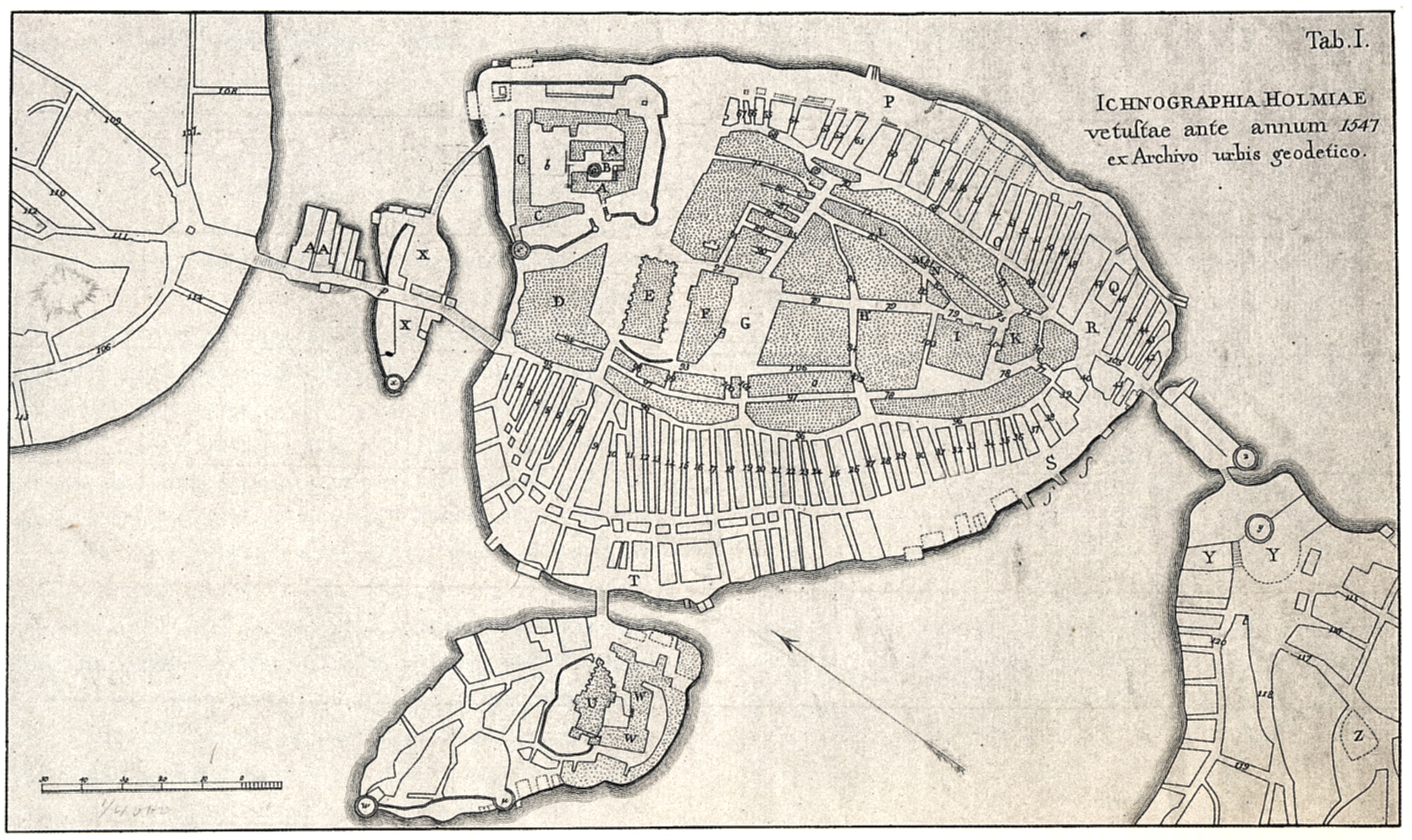
Map 1.2: Map of Gamla Stan 1547, a typical medieval district

Map 1.3: streetscape of Nörrmalm.
Nörrmalm, however is different. This district was created later when the city had to extend. Since the first settlements in Nörrmalm, planning had been a light to develop the city, compared to others cities in Europe which faced uncontrolled developments. Moreover, the plan of 1866 (see Map 1.3) shows us how this part of the city became the center (railway station) and also how the grid shape (see Image 1.3) had taking in account of the geography of the place (by the graduation of red). This place prepared Stockholm for the future and welcomed new inhabitants. It also provided hygienic ideas and green spaces to improve the quality of life within the city.
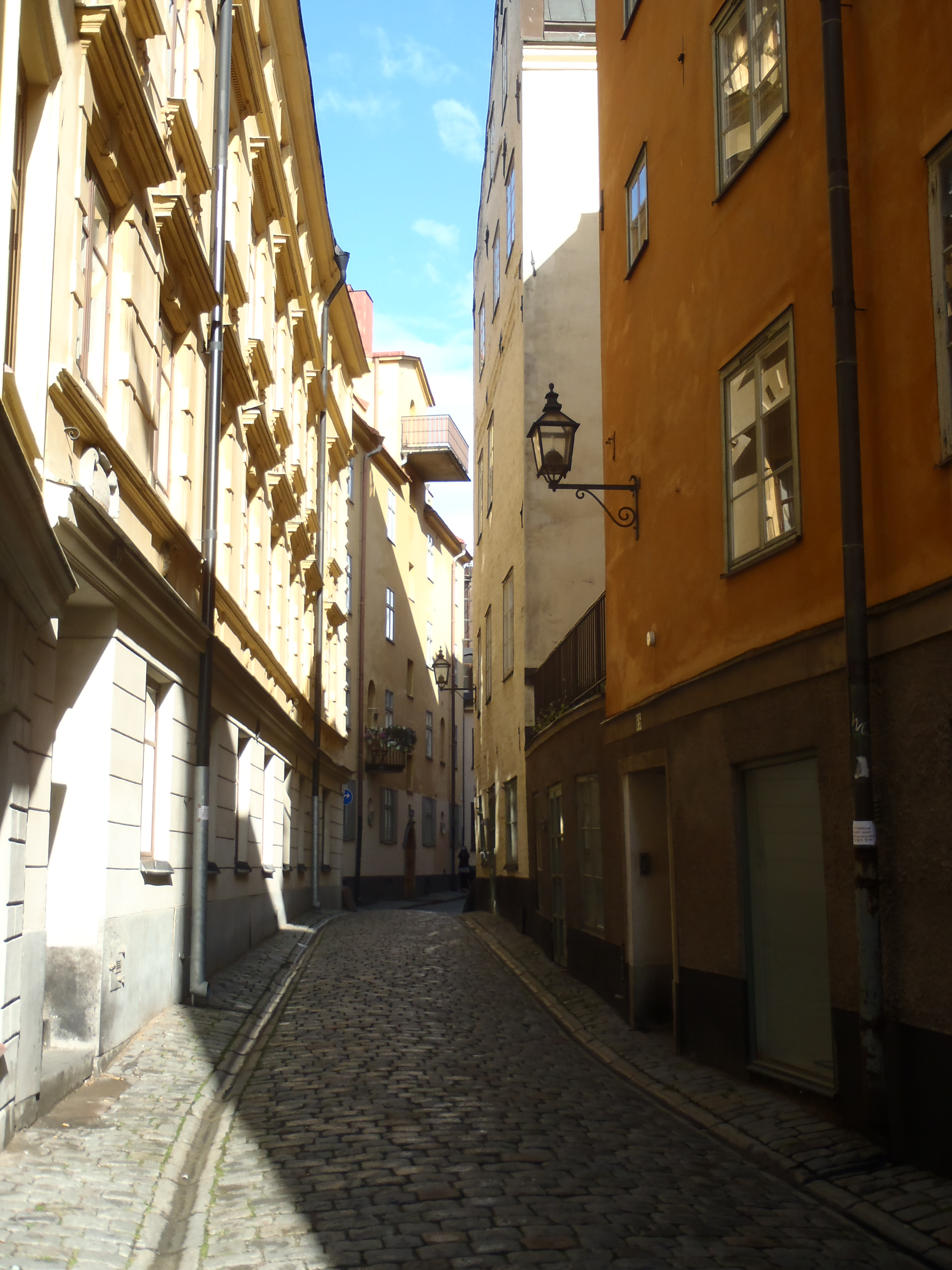
Image 1.2: A street in Gamla Stan

Image 1.3: skyview of the grid of Nörrmalm
Pierre-Joseph Cancellieri| 114112124
Source (click here)
